My Top 10 Favourite Lake District Fells So Far (Plus An Honourable Mention)

I've no trips up to the Lakes planned for the next couple of weeks or so at least so I've decided to fill a gap in the blog by briefly revisiting some older walks (you'll be able to tell from the picture quality of some of them!) and compile my Top 10 favourite fells/walks. I was going to start from number ten and work down to number one, but, when reviewing each one I decided that I liked each for different reasons and found it hard to split them. Some walks were hard, the weather was particularly nice, technical aspects or I just had good company on them so I've decided to list them in no particular order. There's an honorable mention to a none Lake District mountain at the end too just for good measure and because there's a nice story behind it.
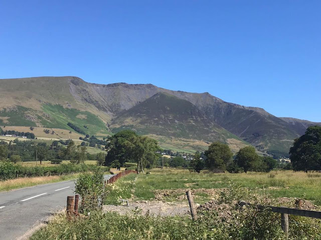
Coniston Old Man
Parking: Walna Scar Car Park
Pubs: Numerous in Coniston. The Sun, Black Bull, The Ship Inn, Crown Inn.
Camping: Coniston Hall Campsite
It's a steady climb from Walna Scar Car Park but starting from here saves a fairly steep walk up from Coniston village, although starting there is perfectly reasonable.
I enjoyed this entire walk but gave the nod to The Old Man although this walk also takes in Brown Pike, Buck Pike and Dow Crag. We descended via Goats Water.
This was my first walk back in the Lakes since I did Fairfield. I'd now begun to invest a little in 'proper' walking gear sporting Karrimor boots
 |
| Buck Pike on the way to The Old Man |
 |
| Wetherlam from the summit. |
Bowfell
Parking: Langdale NT Campsite, NT Car Park by the ODG
Pubs:The Old Dungeon Ghyll (ODG), Stickle Barn, New Dungeon Ghyll
Camping:Langdale NT Campsite.
This walk nearly didn't make it! Bowfell is a fine mountain but I really hate The Band, which is the ridge running up to Three Tarns on the way up. This was my first winter walk and I'd borrowed some strap-on crampons which actually worked well and an old wooden ice axe which wouldn't have looked out of place on display in a museum but it also did it's job well. It was a chilly day but my newly purchased Rab gloves
Very straightforward walk this even in winter when we did it. Head past Stool End Farm then drag yourself up The Band to Three Tarns. This is the col separating Bowfell from Crinkle Crags to the south. Follow the path from there north and then north-west to the summit.
 | |
| Heading to Bowfell summit from Three Tarns |
 |
| Bowfell summit. |
Grasmoor
Parking: NT at Buttermere, End of Newlands Pass next to St James Church, some roadside parking.
Pubs: The Fish and The Bridge in Buttermere.
Camping: Sykes Farm Campsite.
This walk was a definite contender for number 1 if I'd have deiced to number this top 10. Great company on the walk, excellent weather all day, an underrated fell in Grasmoor and all from a glorious Buttermere starting point.
We took the path opposite the Bridge Pub and skirted up Whiteless Breast and then on to Whiteless Pike. We continued on to Wandope by Whiteless Edge. It's no Striding Edge but is a fine airy ridge none the less. Then from the col, head west up the motorway like path up on to Grasmoor. We descended by the far from usual route of Rannerdale Beck which added a bit of adventure to the day and finished with a quick pint in the Bridge with some of us, mentioning no names, nursing sun burnt heads!
 |
| Grasmoor summit. |
 |
| Referee! |
 |
| Grasmoor and Whiteless Pike |
Parking: Wasdale Head Car Park, Wasdale Green Car Park, Some roadside parking (just don't block the road)
Pubs: Wasdale Head Inn
Camping: Wasdale NT Campsite
Another walk that is fairly easy navigation with well defined paths. We followed the path from Wasdale Head roughly east up to the stretcher box at Sty Head. We then took the regular path which is NNW roughly up to the summit of Great Gable. There is also the option from the stretcher box to take the climber's traverse that takes you around the south west flank of Great Gable past the Great Napes, Napes Needle and Sphinx Rock. There's a few options and difficulties of then summiting from there but I've got a scramble up Sphinx ridge in mind for when I return.
 |
| Great Gable |
 |
| Bridge from Wasdale |
 |
| Great Gable summit. |
Steeple
Parking: Bowness Knott Car Park
Pubs: None really close by but two in Ennerdale Bridge.
Camping: Again none really close by but hostels in Ennerdale at Low Gillerthwaite and Black Sail.
Again I've mentioned Steeple but this walk consisted of Caw, Haycock and Scoat Fell before heading on to Steeple. It's a long walk in from Bowness Knott as there's only access by car to Low Gilerthwaite YH if you are staying there and Black Sail YH can only be reached along Ennerdale or by walking over from Buttermere by Scarth Gap or Wasdale by Black Sail Pass.
Cross Dub Char by a bridge just before Low Gilerthwaite and head into the forest where navigation can be a little difficult. You'll cross another beck before hitting the ridge up on to Caw. Once at the top of the ridge the summit of Caw is a short distance to the west. The rest of the route is along easy well defined paths. There's a short airy ridge from Scoat Fell onto Steeple which shouldn't cause any problems, although when I did it there was ice and snow still around which helps concentrate the mind as the drops are near vertical on both sides! This was the first real outing for me in my Scarpa Chamoz
Drop down the north ridge of Steeple and back through the forest for the long walk back to Bowness Knott car park.
 |
| Caw Fell |
 |
| Scoat Fell, Steeple behind. |
 |
| Ennerdale. |
Helvellyn
Parking: Glenridding
Pubs:The Inn On The Lake, The Travellers Rest
Camping: Gillside Camping And Caravan
Helvellyn by Striding Edge, descending by Swirral Edge and taking in Catsycam for good measure. Another contender for number one in this list.
After leaving the car park we took the route that skirts around Birkhouse Moor to the north and leads you to The Hole In The Wall, the beginning of Striding Edge. We stuck to the ridge here but there is a side path that lets you avoid the worst of the exposure. But take your time and be careful, it's really not that bad and you'll be glad to have done it! There's a short scramble on to Helvellyn where you'll find a large wind shelter and summit cairn.
Swirral Edge is much the same as Striding Edge but shorter. A cairn marks the start of Swirral Edge off the plateau of Helvellyn. You can stay on it for Catstycam or descend the path back to Glenridding from here.
 |
| Striding Edge |
 |
| Just before the scramble to the summit. |
 |
| Helvellyns summit cairn. |
 |
| Swirral Edge. You can see Catstycam summit path and the path diverging off back to Glenridding. |
Blencathra
Parking: Blease Road, Threlkeld. Space for about 12 cars.
Pubs: The Horse And Farrier, Threlkeld
Camping: Burns Farm Camp Site
A nice easy start to this walk but don't get too comfortable! The path leaves the car park heading roughly north until you cross a stone wall. Head east along the wall until you cross a beck and this is the start of Halls Fell Ridge.
Up until now there's not been too much height gain but that soon changes. The path is steep on the initial stages of the fell and only abates a little once reaching the jagged main ridge.
And that's where the fun begins. There's some exposure here but nothing like Striding Edge. It's just fun. Stick to the crest for the maximum experience. And the best bit, you arrive directly on to the summit cairn of Blencathra at the top of the ridge.
There's plenty of route options for descent. We walked the length of the ridge to the west and descended to the car park down Blease Fell.
 |
| Halls Fell Ridge. |
 |
| View down the ridge. |
 |
| Blencathra summit cairn at top of the ridge. |
Langdale Pikes
Parking: Car park on main road near the New Dungeon Ghyll, NT Car Park next to Stickle Barn
Pubs: Stickle Barn, New Dungeon Ghyll, Old Dungeon Ghyll
Camping: Langdale NT Camp Site.
I've cheated and lumped them all in together but this walk takes in Pavey Ark, Thurnacarr Knott, Harrison Stickle, Pike O'Stickle and Loft Crag. The highlights of the walk being a bit of a scramble up behind Pavey Ark and Pike O'Stickle.
Leaving the car park, we followed the path that runs along side Stickle Gyhll up to Stickle Tarn. There's a few options from here including a scramble up Jack's Rake, but we went up a rake that runs west up to the summit of Pavey Ark. From there it was on to the underwhelming Thurnacarr Knott before heading for Harrison Stickle.
You then have to lose a little height before climbing up on to Pike O'Stickle. We then picked off Loft Crag before descending along the ravine of Dungeon Ghyll itself which is quite impressive back to the start of the walk.
The paths are all clear and the routes to the various tops are all obvious, at least in clear weather.
 |
| Harrison Stickle |
 |
| Pike O'Stickle |
Helm Crag
Parking: Grasmere, On road near Town Head Farm
Pubs: The Inn At Grasmere, Tweedies Bar, Travellers Rest
Camping: Skelith Fold Camp Site, Bays Brown Camp Site
This is one that nearly didn't make it. Helm Crag is a fine fell but this route took in Steel Fell, Calf Crag, Gibson Knott and then Helm Crag. The summit area of Calf Crag was some of the worst bog I've encountered in the Lakes to the point I nearly cut the route short and turned back . Maybe one for a dry spell or when frozen in winter.
From my parking place on the road it was straight onto the ridge of Steel Fell with an obvious path. The summit has fine views down Thirlmere. Then across to the bog fest of Calf Crag before heading south east across Gibson Knott, which as it's name suggests undulates up and down over lots of dimples on the ridge.
Helm Crag's summit has a rock formation known as the Lion and The Lamb which is the true summit and one Wainwright failed to make the top of himself. It's a fairly simple climb from the summit but there is a significant drop of behind which can be enough to put you off trying. It was a little windy on this walk so I gave in after a couple of tries I'm sorry to say.
The path drops off to the south and you can pick up a road back into Grasmere or walk back north to your road side parking.
 |
| Helm Crag from Gibson Knott. |
 |
| Attempting the Lion and The Lamb. |
Haystacks
Parking: Gatesgarth Farm near end of Honister Pass
Pubs: The Fish and Bridge Inn, Buttermere
Camping: Sykes Farm Camp Site
This walk also nearly didn't make it in. Not because I didn't like it but because I can't count!!
There's room for about 10 cars or so at Gatesgarth and it's right at the start to the path up on to Haystacks.
It's a steady climb following the path that takes you eventually up and over Scarth Gap into Ennerdale, but we're not going over there today and there's a path that branches off roughly east to Haystacks.
There's some scrambling then as you head for the summit but it's all very easy and enjoyable and before you know it you reach the top.
There's a couple of cairns on the top, the northernmost being the Wainwright top. And talking of Wainwright, Haystacks and Innominate Tarn are where his ashes were scattered, this being his favourite fell.
For our descent, we took the path towards Fleetwith Pike, which could be added to the walk if you like, but when we reached Warnscale Bothy we followed the path back down to the car park along Warnscale Beck.
 |
| View of Buttermere on the ascent. |
 |
| Great gable from the summit. |
An honourable mention - Cadir Idris
I've included this walk as Cadir Idris is a fine mountain to climb with a sad but hopefully uplifting story attached.
My friend Gaz, whom I mentioned previously had a mate known affectionately as Tony Sideburns. I met him a few times as he would come along on camps and walks with us but as he was an older gent, would come along to be a drop off/ pick up driver which he enjoyed but mainly for a few drinks and a meal in the pub after the walk. He was ex army and although he was still fairly fit, his walking days were long over.
One day out of the blue he took ill, and after a short stay in hospital, sadly passed away.
Now Tony had often mentioned to Gaz that he wanted to climb Cadir Idris but had never been able to. So Gaz got the ball rolling to get as many people who knew Tony on a walk up Cadir Idris.
It was a warm autumn day when we climbed and it was slow going at first, well for most of the way, it's a serious climb and the descent wasn't much better. The views on the way are superb and even better at the summit.
I did forget to mention that Tony had been cremated after his death, and after being taken to the area he grew up in and having some ashes scattered there, his urn made the climb up to the top of Cadir Idris with us before they were buried discretely on the summit. He'd made it up at last!
 |
| It's that way. |
 |
| Tony and the gang on Cadir Idris. |
 |
| Stunning views. |
 | |||
| That's Tony on the left. And yes, the pub had shut! |
Well that's it until next time. If you've enjoyed reading or this post has helped you, please subscribe, follow and share!
Comments
Post a Comment