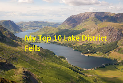
Life On The Edge
Blencathra via Sharp Edge, Mungrisdale Common and Bannerdale Crags
Parking:There's a car park just off the A66 at Scales next to the White Horse Pub. Some on road parking and there's also a small car park fit for about 6 cars further along the road to the left of the main car park near to Comb Beck.
Pub:The White Horse Inn at Scales is ideally located to finish this walk.
Camping:Burns Farm Camp Site
Sharp Edge. Possibly only trumped as being the Lakes most well known ridge route by Striding Edge on Helvellyn. It's a Grade 1 scramble meaning you'll be using your hands and feet as well as your backside for some parts!
"Sharp Edge is a rising crest of naked rock of sensational and spectacular appearance, a breaking wave carved in stone. The crest itself is sharp enough for shaving (the former name was Razor Edge) and can be traversed only at risk of some damage to tender parts" That was Wainwrights description of the ridge. It's a notorious hot spot for mountain rescue and there have been numerous incidents on it over the years and at least 9 deaths. In the wet or ice and snow it's a serious challenge and one that most of us are best to put off for another day. Even on a day like today where conditions were nearly pefect, care is needed and there are plenty of polished bits of rock from the thousands of previous walkers that have passed before. It's not to be taken lightly and isn't for those that haven't got a head for heights.There's lots of other stories and warnings you hear in relation to Sharp Edge giving it a formidable reputation.
I don't know why I put Sharp Edge off!!
I'd climbed Blencathra on two previous occasions. The first time, the weather was miserable and it continued to worsen as the walk went on. I made it to Scales Tarn, so got to see Sharp Edge up close and it does look a daunting prospect from that vantage point. It wasn't on the agenda for that day with the path going past Scales Tarn the planned route, but we called the walk off there as the weather deteriorated. The second time was a successful walk to the top going up via Halls Fell Ridge, another fine route, and then down by Blease Fell.
I'd always told myself that I'd put off Sharp Edge because I'd already climbed Blencathra, but I can't deny that descriptions and stories like I mentioned above partially played a part in me choosing other hills to climb.
There were no plans for me to walk this weekend, my mates who I usually walk with had plans and couldn't get away. On the Saturday afternoon I was on the page of a Facebook group I'm a member of (Lets Walk The Lakes if you're on Facebook and request to join,a great group page) and noticed this walk posted up. I had a think about it and decided I'd go along, so I let them know that I'd be tagging along but would leave them on Blencathra summit as their descent route was Halls Fell, where I'd continue on a bag a few more Wainwrights.
Conditions were nearly perfect. It had been hot and dry for well over a week and if anything it was almost too hot to walk. A temperature reading of 33.3 degrees was taken later on in the day!
I managed to get parked next to the White Horse pub at Scales and met up with the other 4 people. We introduced ourselves to each other and quickly set about the walk.
We took a path from behind the pub that rose steeply, leading to the path that climbs fairly steeply up to the top of Mousthwaite Comb.
From there it's an obvious path that raises gently alongside the river Glenderamackin before shorter steep section up past Scales Beck and up to Scales Tarn.
Scales Tarn is a great spot to stop and take in the view of Sharp Edge and take on a drink and a little snack before hitting the ridge itself. It was a hot day and there were lots of people swimming in the tarn and I admit it looked very tempting just to jump in but I resisted the urge.
From Scales Tarn it's another short steep walk and up to the beginning of Sharp Edge. This is it. The moment you've been putting off. Lets get this done!
Sharp Edge starts with an easy little scramble but you are soon on the knife edge arete. It's easy enough to stick close to the crest of the ridge but there are a few paths less exposed down to the right if you'd prefer to go that way. You soon get to a little step down that is a little exposed on both sides, but it's again easy enough to navigate over and you're soon back moving along with good foot and hand holds most of the way along.
Shortly before the end of the ridge and the beginning of Foule Crag, there's a section known as Bad Step. It's similar to the step down faced earlier on the ridge but is a little bigger a gully running down on both sides. It's fairly easily navigated though as you can just sit and lower yourself to the next section and really is no trouble.
And that's the ridge nearly done. I've got to say I don't know what there was to worry about. Yes you've got to concentrate and treat the ridge with respect or you could quite easily fall and get injured or worse, but all told it was easy to cross. I actually felt safer on Sharp Edge than I did on Striding Edge (not that I was scared on that either!), I think because its more hands on adding to the feeling of safety. It's also short and is over too quickly but it was fun, lots of fun, and I'd gladly go back and cross it again in the future.
The fun doesn't end there though as there's still Foule Crag to climb. It looks very vertical as you start the climb but there's lots of good hand holds and foot grips and it's pretty straightforward to pick your route up. There's plenty of polished stone here too but there's plenty of alternative rock to choose from. A bit of effort required here, but again lots of fun.
From the top of Foule Crag, the slope eases off and it's a pleasant stroll from here up to Halls Fell Top, the summit of Blencathra. There's a large memorial cross made out of white quartz stone on this section on the right. It's that big I completely missed it! The view is better the other way though looking down to the path just walked at Sharp Edge and Scales Tarn, that's my excuse anyway.
From the summit of Blencathra, I said my goodbyes to the guys I'd been walking with. A lovely bunch of people and helped me a lot getting over Sharp Edge.
The plan was to go and climb Mungrisdale Common, Bannerdale Crags, Bowscale Fell and Souther Fell. I set off in a north-easterly direction off Blencathra and soon picked up the path to Mungrisdale Common from below Atkinson Pike.
I'd certainly not recommend going out of your way to bag Mungrisdale Common if you don't have to, and it's best to tag on to a walk like today or one of the other surrounding fells. It's a big, boring and featureless mound and offers little interest. Even on this walk and after a long dry warm spell it was a little soft underfoot and there was still some patches of water about. I'd imagine it's even less enticing to walk after rain, it must be fairly boggy. Even the summit cairn is a reserved affair but it's not all bad, there is a reasonable view to the north-west and over towards Keswick.
The path over to Bannerdale crags is all mostly on grass and can be faint in parts. It's easy enough to follow on a nice day as you can just aim at Bannerdale Crags, but it would be a little trickier in mist and bad weather. There's a gradual increase in steepness as you make your way to the summit and the path completely disappeared at one point, but it's not much of a problem. It's at this point that the temperature suddenly seemed to rise and I could almost feel my energy draining. I looked over to Bowscale Fell and decided that it would have to wait for another day along with Souther Fell. The walk along the ridge looked great too.
From Bannerdale Crags Summit, I headed down a faint path across grass on it's steep southerly slopes. You eventually see the River Glenderamackin come back in to view where there's a bridge you can cross back over to Mousthwaite Comb. From there it's an easy stroll over to the other side and a steady walk back down towards the road leading back to the car park, and the pub!
A great but hot day and I finally did Sharp Edge. Go and get it done if you're even considering it, you won't regret it and it's really quite easy. But do it in fine weather and treat it with respect still or it could still chew you up and spit you out if you're not careful. I really shouldn't have waited so long to do it. It won't be as long until my next time.
Parking:There's a car park just off the A66 at Scales next to the White Horse Pub. Some on road parking and there's also a small car park fit for about 6 cars further along the road to the left of the main car park near to Comb Beck.
Pub:The White Horse Inn at Scales is ideally located to finish this walk.
Camping:Burns Farm Camp Site
Sharp Edge. Possibly only trumped as being the Lakes most well known ridge route by Striding Edge on Helvellyn. It's a Grade 1 scramble meaning you'll be using your hands and feet as well as your backside for some parts!
"Sharp Edge is a rising crest of naked rock of sensational and spectacular appearance, a breaking wave carved in stone. The crest itself is sharp enough for shaving (the former name was Razor Edge) and can be traversed only at risk of some damage to tender parts" That was Wainwrights description of the ridge. It's a notorious hot spot for mountain rescue and there have been numerous incidents on it over the years and at least 9 deaths. In the wet or ice and snow it's a serious challenge and one that most of us are best to put off for another day. Even on a day like today where conditions were nearly pefect, care is needed and there are plenty of polished bits of rock from the thousands of previous walkers that have passed before. It's not to be taken lightly and isn't for those that haven't got a head for heights.There's lots of other stories and warnings you hear in relation to Sharp Edge giving it a formidable reputation.
I don't know why I put Sharp Edge off!!
I'd climbed Blencathra on two previous occasions. The first time, the weather was miserable and it continued to worsen as the walk went on. I made it to Scales Tarn, so got to see Sharp Edge up close and it does look a daunting prospect from that vantage point. It wasn't on the agenda for that day with the path going past Scales Tarn the planned route, but we called the walk off there as the weather deteriorated. The second time was a successful walk to the top going up via Halls Fell Ridge, another fine route, and then down by Blease Fell.
 |
| The mighty Blencathra |
I'd always told myself that I'd put off Sharp Edge because I'd already climbed Blencathra, but I can't deny that descriptions and stories like I mentioned above partially played a part in me choosing other hills to climb.
There were no plans for me to walk this weekend, my mates who I usually walk with had plans and couldn't get away. On the Saturday afternoon I was on the page of a Facebook group I'm a member of (Lets Walk The Lakes if you're on Facebook and request to join,a great group page) and noticed this walk posted up. I had a think about it and decided I'd go along, so I let them know that I'd be tagging along but would leave them on Blencathra summit as their descent route was Halls Fell, where I'd continue on a bag a few more Wainwrights.
Conditions were nearly perfect. It had been hot and dry for well over a week and if anything it was almost too hot to walk. A temperature reading of 33.3 degrees was taken later on in the day!
 |
| Scales Farm Country Guest House was the meeting spot. The car park is just a little up the road to the right. |
I managed to get parked next to the White Horse pub at Scales and met up with the other 4 people. We introduced ourselves to each other and quickly set about the walk.
We took a path from behind the pub that rose steeply, leading to the path that climbs fairly steeply up to the top of Mousthwaite Comb.
From there it's an obvious path that raises gently alongside the river Glenderamackin before shorter steep section up past Scales Beck and up to Scales Tarn.
 |
| Walking up to Mousthwaite Comb |
 |
| Path along the River Glenderamackin. |
 |
| The short steep pull up to Scales Tarn. |
Scales Tarn is a great spot to stop and take in the view of Sharp Edge and take on a drink and a little snack before hitting the ridge itself. It was a hot day and there were lots of people swimming in the tarn and I admit it looked very tempting just to jump in but I resisted the urge.
 |
| Swimmers in Scales Tarn cooling off. |
 |
| The imposing Sharp Edge |
From Scales Tarn it's another short steep walk and up to the beginning of Sharp Edge. This is it. The moment you've been putting off. Lets get this done!
Sharp Edge starts with an easy little scramble but you are soon on the knife edge arete. It's easy enough to stick close to the crest of the ridge but there are a few paths less exposed down to the right if you'd prefer to go that way. You soon get to a little step down that is a little exposed on both sides, but it's again easy enough to navigate over and you're soon back moving along with good foot and hand holds most of the way along.
 |
| The start of Sharp Edge |
 |
| The first little step on the ridge. |
 |
| A dog showing us how it's done. Well he has got 4 wheel drive! |
 |
| It's easy enough to stick to the crest of the ridge most of the way. |
 |
| Sharp Edge with Foule Crag beyond. |
Shortly before the end of the ridge and the beginning of Foule Crag, there's a section known as Bad Step. It's similar to the step down faced earlier on the ridge but is a little bigger a gully running down on both sides. It's fairly easily navigated though as you can just sit and lower yourself to the next section and really is no trouble.
 |
| Just past the Bad Step |
And that's the ridge nearly done. I've got to say I don't know what there was to worry about. Yes you've got to concentrate and treat the ridge with respect or you could quite easily fall and get injured or worse, but all told it was easy to cross. I actually felt safer on Sharp Edge than I did on Striding Edge (not that I was scared on that either!), I think because its more hands on adding to the feeling of safety. It's also short and is over too quickly but it was fun, lots of fun, and I'd gladly go back and cross it again in the future.
The fun doesn't end there though as there's still Foule Crag to climb. It looks very vertical as you start the climb but there's lots of good hand holds and foot grips and it's pretty straightforward to pick your route up. There's plenty of polished stone here too but there's plenty of alternative rock to choose from. A bit of effort required here, but again lots of fun.
 | ||
| The climb up Foule Crag with Sharp Edge behind. |
 | ||
| Group shot after cracking Sharp Edge. |
From the top of Foule Crag, the slope eases off and it's a pleasant stroll from here up to Halls Fell Top, the summit of Blencathra. There's a large memorial cross made out of white quartz stone on this section on the right. It's that big I completely missed it! The view is better the other way though looking down to the path just walked at Sharp Edge and Scales Tarn, that's my excuse anyway.
 | |
| Most of the path walked back to the top of Mousthwaite Comb. |
 |
| Summit shot on Halls Fell, Blencathra |
From the summit of Blencathra, I said my goodbyes to the guys I'd been walking with. A lovely bunch of people and helped me a lot getting over Sharp Edge.
The plan was to go and climb Mungrisdale Common, Bannerdale Crags, Bowscale Fell and Souther Fell. I set off in a north-easterly direction off Blencathra and soon picked up the path to Mungrisdale Common from below Atkinson Pike.
 | ||
| The path to Mungrisdale Common |
I'd certainly not recommend going out of your way to bag Mungrisdale Common if you don't have to, and it's best to tag on to a walk like today or one of the other surrounding fells. It's a big, boring and featureless mound and offers little interest. Even on this walk and after a long dry warm spell it was a little soft underfoot and there was still some patches of water about. I'd imagine it's even less enticing to walk after rain, it must be fairly boggy. Even the summit cairn is a reserved affair but it's not all bad, there is a reasonable view to the north-west and over towards Keswick.
 |
| Mungrisdale Common 'summit' cairn. |
 | ||||
| View over towards Keswick. |
 | ||||
| The faint path over to Bannerdale Crags, just seeen in the centre distance. |
The path over to Bannerdale crags is all mostly on grass and can be faint in parts. It's easy enough to follow on a nice day as you can just aim at Bannerdale Crags, but it would be a little trickier in mist and bad weather. There's a gradual increase in steepness as you make your way to the summit and the path completely disappeared at one point, but it's not much of a problem. It's at this point that the temperature suddenly seemed to rise and I could almost feel my energy draining. I looked over to Bowscale Fell and decided that it would have to wait for another day along with Souther Fell. The walk along the ridge looked great too.
 |
| Bowscale Fell seen from Bannerdale Crags. One for another day. |
 |
| Bannerdale Crags summit. |
From Bannerdale Crags Summit, I headed down a faint path across grass on it's steep southerly slopes. You eventually see the River Glenderamackin come back in to view where there's a bridge you can cross back over to Mousthwaite Comb. From there it's an easy stroll over to the other side and a steady walk back down towards the road leading back to the car park, and the pub!
 |
| Route map of the walk. Yes I did loose the track a little on Bannerdale Crags! |
A great but hot day and I finally did Sharp Edge. Go and get it done if you're even considering it, you won't regret it and it's really quite easy. But do it in fine weather and treat it with respect still or it could still chew you up and spit you out if you're not careful. I really shouldn't have waited so long to do it. It won't be as long until my next time.
Comments
Post a Comment